Cadastral Mapping Configuration Data Model
The Cadastral Mapping Configuration parcel fabric is maintained by reflecting the contents of the associated persistent topology model into the active model. Cadastral Mapping Configuration "listens" for topology model changes via an asynchronous call-back mechanism. The topology is the truth and the user interacts with XFM elements created by reflecting the topology model’s state. When a Cadastral Mapping Configuration tool is used or a user edit is detected to have interacted with a Cadastral Mapping Configuration feature, an appropriate topology operation is output to the respective topology model(s) and the resultant changes are reflected back into the active DGN.
The Cadastral Mapping Configuration data model consists of standard XFM features linked to persistent topology model primitives. For example, a simple parcel and its associated topology might appear as:
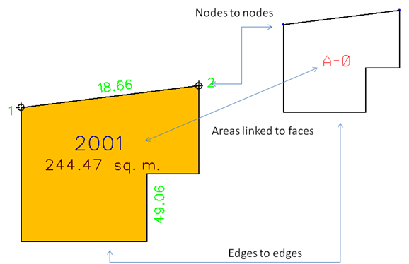
In the active DGN there are the following features:
Each feature is linked to its corresponding topology primitive: from a feature we can obtain the topo primitive(s); from a primitive we can obtain the feature(s).
Each feature is defined as a feature collection consisting of a primary feature and optional sub-features:
- Node_Collection feature and properties:
Node text
Node (cell)
- Boundary_Collection feature and properties:
Boundary (linear feature)
Boundary text
- Parcel_Collection feature and properties:
Parcel (closed feature)
Parcel label text
Parcel area text
"Change tracker" functions for the standard XFM features are provided via the XFM system.